< Pre-Construction Surveys & Planning >
Accurate site intelligence to reduce uncertainty before design and delivery.
High-precision aerial surveys supporting early-stage engineering, design, feasibility, and planning activities. Designed for both complex construction sites and linear corridors.

< OVERVIEW >
Pre-Construction Surveys & Planning.
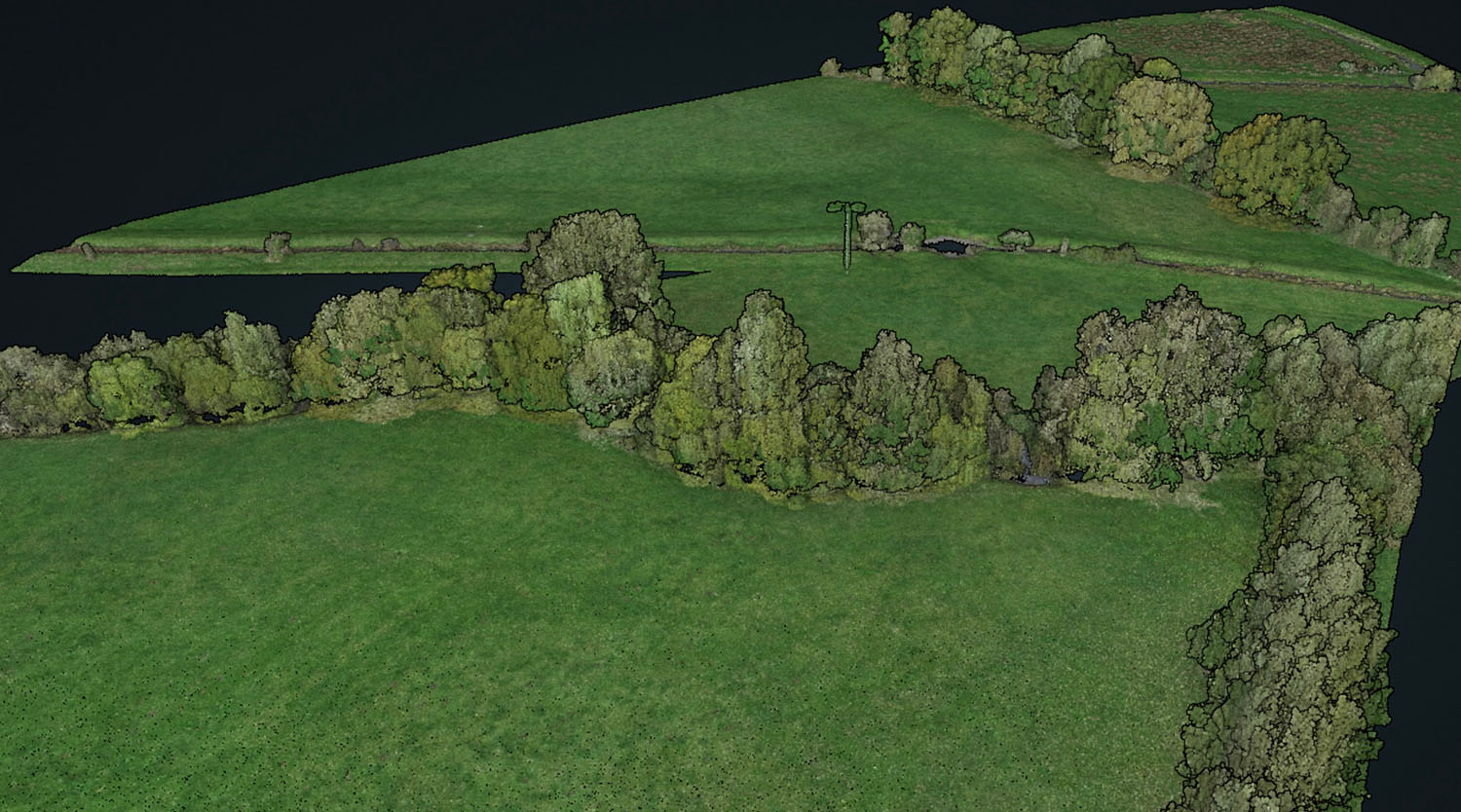
Good engineering decisions start with accurate site intelligence. StirlingX delivers pre-construction drone surveys covering terrain, topography, corridor routing and obstruction identification across sites of any scale, using LiDAR and photogrammetry payloads flown on automated UAV missions. The outputs feed directly into planning, feasibility and BIM workflows, giving project teams the data they need before ground investigations begin.
By capturing complex terrain in hours rather than days, we reduce the assumptions, access constraints and cost overruns that follow from incomplete site data.

< Key Applications >
What we do.

Topographic and terrain surveys. Drone topographic surveys of construction sites, access routes, slopes and undeveloped land, producing centimetre-accurate terrain models.

Corridor and route mapping. Aerial surveys of proposed infrastructure corridors covering roads, pipelines, overhead lines, cable routes and railway alignments, capturing the full survey strip in a single mission.

Engineering feasibility assessments. Structured data packages to support feasibility and optioneering at concept stage.

Obstruction identification. Aerial survey and 3D modelling to identify existing structures, vegetation, utilities and topographic constraints within a proposed project footprint.

Visualisation for planning teams. Photorealistic 3D site models, fly-through video and rendered overlays that communicate proposed works to planning teams, stakeholders and public consultees.

Data packs for BIM and engineering tools. Survey deliverables formatted for direct import into AutoCAD, Revit, Civil 3D, 12d, MicroStation and other common engineering environments
< Process >
How we work.
Define Scope
We start by understanding the engineering objective rather than just the survey area. That means agreeing on required accuracy tolerances, output formats, coordinate systems and the specific data your team needs at each project stage. For linear projects or large sites, we assess whether BVLOS operations will reduce survey time and mobilisation cost. A clear scope at this stage means no rework and no coverage gaps when you need the data.
Capture
Drone survey missions are planned and flown on automated paths, with LiDAR and photogrammetry payloads selected to match the terrain type and data requirement. Where ground control is required for survey-grade accuracy, GCPs are established before flight and validated against known benchmarks. BVLOS-approved operations allow us to fly extended corridors and wide-area sites without breaking the mission into multiple mobilisations.
Process
Raw LiDAR and imagery data is processed through georeferencing, noise filtering, ground classification and model generation workflows to produce clean, accurate engineering datasets. Typical deliverables include digital terrain models, digital surface models, classified point clouds and orthorectified imagery, all referenced to the specified coordinate system.
Analyse
Processed terrain data is interrogated against the engineering objectives agreed at scoping stage. Gradient analysis, cut-and-fill calculations, corridor comparisons and constraint overlays are generated to support feasibility decisions or route selection. Where planning submissions are involved, we extract the specific outputs planning teams require, including cross-sections, long sections and annotated site plans.
Deliver
Project teams receive a structured data pack containing all survey deliverables, a technical report covering methodology, accuracy and coordinate metadata, and any visualisation outputs agreed at scoping. Engineering files are formatted for direct import into your CAD or BIM environment. For projects with ongoing survey requirements, data is stored in a structured archive so repeat surveys can be directly compared against the baseline.
< TECHNOLOGY STACK >
The foundation that powers your operations.
StirlingX runs on infrastructure designed for reliability and speed. Our platform integrates seamlessly with what you already have, no rip and replace required.

Engineering-grade LiDAR

High-resolution photogrammetry
Corridor and long-range flight capability
Dashboard insights for terrain and constraint mapping


< Benefits >
How we're different.

Accurate design inputs
For engineering teams.

Reduced rework
From early risk identification.

Better feasibility decisions
With complete site insight.

Faster planning cycles
With instant stakeholder visuals.

Seamless integration
Into engineering workflows (CAD/BIM).
“We’ve worked with StirlingX since 2019 and were delighted to award them this framework. Their ability to combine cutting-edge permissions, efficiency, and data integrity makes them an invaluable partner.”
“The ability to pinpoint exact defect locations was invaluable given the size of the roofs. Data management is much easier.”
< Case Studies >
What we've accomplished. Real solutions from real projects.


Find answers about how StirlingX works and what to expect.
Need more information? Reach out to discuss your specific situation.

How long does implementation take?
Will this disrupt our operations?
What about our existing systems?
How do you measure success?
What support continues after launch?
Ready to move forward?
Get in touch with our team to discuss your specific needs today.